Log in
All resources
Create a design
1,126 Free Images of Charts And Maps
topographic map of france, 1864
lemercier & cie.
lawrence h. slaughter collection of english maps, charts, globes, books and atlases
frederick william beechey
john outhett
maps by emanuel bowen
emanuel bowen
maps by john cary
john cary
a voyage to abyssinia, and travels into the interior of that country, executed under the orders of the british government in the years 1809 & 1810
historical map collection
maps by emanuel bowen
lawrence h. slaughter collection of english maps, charts, globes, books and atlases
covens en mortier
navigantium atque itinerantium bibliotheca
18th-century maps of south asia
eran laor cartographic collection
willem albert bachiene
19th-century maps of the mediterranean sea
the bottom of the sea (1870)
maps in the library of congress
1875 maps of california
admiralty charts 2401-2600
achill head
voyages and travels to india, ceylon, the red sea, abyssinia, and egypt, vol. 3
henry cooper (engraver)
maps in the british museum
1780s maps of france
admiralty charts 1801-2000
preston, lancashire
1670s maps of the iberian peninsula
hugo allardt
maps of san francisco bay
admiralty map details
admiralty charts region r: usa and mexico west coasts
admiralty charts 1801-2000
18th-century french nautical charts
old maps of lesbos
maps in the british museum
maps of the irish sea
a voyage to abyssinia, and travels into the interior of that country, executed under the orders of the british government in the years 1809 & 1810
john outhett
lawrence h. slaughter collection of english maps, charts, globes, books and atlases
pre-raphaelite brotherhood
portolan charts by willem and johannes blaeu
old maps of holland
maps of cresques family
abraham cresques
maps in the library of congress
1758 maps of cuba
a voyage to abyssinia, and travels into the interior of that country, executed under the orders of the british government in the years 1809 & 1810
john outhett
admiralty charts 2001-2200
westport, county mayo
works by johan vinckeboons
image restoration
a voyage to abyssinia, and travels into the interior of that country, executed under the orders of the british government in the years 1809 & 1810
john outhett
admiralty charts 1801-2000
maps of tawi-tawi
old maps of the province of a coruña
lucas janszoon waghenaer
cetus (constellation) in art
uranometria
a voyage to abyssinia, and travels into the interior of that country, executed under the orders of the british government in the years 1809 & 1810
john outhett
galicia (spain) in the 1390s
galicia in portolan charts
admiralty charts 2601-2800
blacksod bay
catalan atlas, 1959 reproduction
coats of arms on maps
a map of the provinces of new york and new jersey, with a part of pennsylvania and the province of quebec
lawrence h. slaughter collection of english maps, charts, globes, books and atlases
a map of the provinces of new york and new jersey, with a part of pennsylvania and the province of quebec
lawrence h. slaughter collection of english maps, charts, globes, books and atlases
a map of the provinces of new york and new jersey, with a part of pennsylvania and the province of quebec
lawrence h. slaughter collection of english maps, charts, globes, books and atlases
voyages and travels to india, ceylon, the red sea, abyssinia, and egypt, vol. 2
henry cooper (engraver)
charts and maps of the royal museums greenwich
1693 maps
le neptune francois
charles pène 8th
1740s maps of the united kingdom
maps in the british museum
maps of cresques family
abraham cresques
philip island, norfolk island
views from admiralty charts
maps of the republic of venice
17th-century maps of istria
maps of the west-indische compagnie
1665
adam gottlieb schneider
1812 maps of germany
maps by thomas kitchin
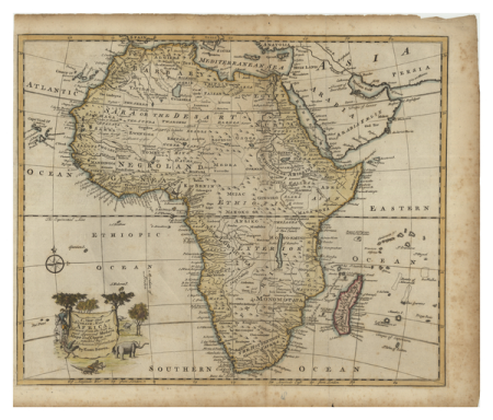
1782 maps of africa
1747 maps of north carolina
maps by emanuel bowen
portolan charts made in the 17th century
maps by willem and johannes blaeu
1690s maps of the caribbean
1690s maps of the americas
old maps of french guiana
1630s maps of brazil
admiralty charts region t: west indies and central america
admiralty charts 401-600
catalan atlas, 1959 reproduction
rhumbline network
lawrence h. slaughter collection of english maps, charts, globes, books and atlases
covens en mortier
the royal navy, a history from the earliest times to present by w. laird clowes
johannes ruysch
maps in the museo correr
francesco de cesanis
lawrence h. slaughter collection of english maps, charts, globes, books and atlases
nypl lionel pincus and princess firyal map division
maps in the library of congress
1770s maps showing history
views from admiralty charts
san francisco bay
1810s maps of the near east
maps by john cary
lawrence h. slaughter collection of english maps, charts, globes, books and atlases
nypl lionel pincus and princess firyal map division
admiralty charts 1-200
skerries, dublin
drawings by johan frederik clemens in the statens museum for kunst
pencil
lawrence h. slaughter collection of english maps, charts, globes, books and atlases
nypl lionel pincus and princess firyal map division
1620s maps of the iberian peninsula
maps by willem and johannes blaeu
18th-century french nautical charts
old maps of lemnos
drawings by johan frederik clemens in the statens museum for kunst
pencil
1810s maps of the near east
maps by john cary
maps in the topographia austriacarum (merian)
baroque
maps of circumnavigations of the world
1740s maps of the world
18th-century maps of the atlantic ocean
maps by emanuel bowen
topographic map of france, 1864
lemercier & cie.
topographic map of france, 1864
lemercier & cie.
topographic map of france, 1864
lemercier & cie.
topographic map of france, 1864
lemercier & cie.
topographic map of france, 1864
lemercier & cie.
topographic map of france, 1864
lemercier & cie.
topographic map of france, 1864
lemercier & cie.
portolan charts by willem and johannes blaeu
old maps of holland
maps by willem and johannes blaeu
maps of the wadden sea
topographic map of france, 1864
lemercier & cie.
topographic map of france, 1864
lemercier & cie.
topographic map of france, 1864
lemercier & cie.
topographic map of france, 1864
lemercier & cie.
topographic map of france, 1864
lemercier & cie.
topographic map of france, 1864
lemercier & cie.
topographic map of france, 1864
lemercier & cie.
topographic map of france, 1864
lemercier & cie.
topographic map of france, 1864
lemercier & cie.
topographic map of france, 1864
lemercier & cie.
topographic map of france, 1864
lemercier & cie.
topographic map of france, 1864
lemercier & cie.
topographic map of france, 1864
lemercier & cie.
topographic map of france, 1864
lemercier & cie.
topographic map of france, 1864
lemercier & cie.
naples, biblioteca nazionale manuscripts
maps of cresques family
topographic map of france, 1864
lemercier & cie.
topographic map of france, 1864
lemercier & cie.
topographic map of france, 1864
lemercier & cie.
topographic map of france, 1864
lemercier & cie.
topographic map of france, 1864
lemercier & cie.
topographic map of france, 1864
lemercier & cie.
topographic map of france, 1864
lemercier & cie.
701 - 800 of 1,126
Next page
/ 12